
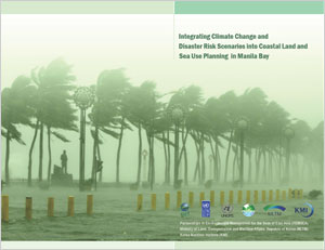
Integrating climate change and disaster risk scenarios into coastal land and sea use planning in Manila Bay
PUBLICATION DATE:
Friday, June 01, 2012
PUBLICATION TYPE:
Reports
STATUS:
Out of Print
DESCRIPTION:
One of the key issues facing governments throughout the East Asian Seas (EAS) region is the impact of climate change, variability and extremes, particularly in coastal areas. Manila Bay is no exception, with incidents of flooding, storm surges, saltwater intrusion and erosion occurring with increasing frequency or heightened intensity. Of special concern is the threat of sea level rise in the Bay area and its effects on infrastructure as well as social and economic development in the area. The Manila Declaration, which was signed by the Ministers and Senior Government Officials from the Partnerships in Environmental Management for the Seas of East Asia (PEMSEA) Partner Countries in December 2009, called for countries of the region to strengthen and accelerate the implementation of integrated coastal management (ICM) for sustainable development and climate change adaptation in coastal areas of the region. In Manila Bay, the Department of Environment and Natural Resources (DENR) – River Basin Coordinating Office (RBCO), Coastal and Marine Management Office (CMMO) and Manila Bay Coordinating Office (MBCO), and PEMSEA have been working with local government units (LGUs) to scale up the implementation of ICM around the Bay’s coastline, building on the experience of ICM programs in the Provinces of Bataan and Cavite. One of the major thrusts of ICM development and implementation is the preparation of an integrated land and sea use plan. This calls for the conduct of coastal use zoning, which will serve as a guide in the preparation of a plan and regulatory system to allocate the appropriate zones and corresponding uses of the coastal and marine area. Coastal use zoning is based on the functional capability and suitability of coastal waters and land as to the desired uses, the development envisioned by the stakeholders, existing policies and ecological, cultural and traditional considerations. The zoning process is a socio-political matter requiring scientific and technical inputs, involving multi-sector participation and extensive consultation with concerned stakeholders in order to reach consensus on the various zones and their corresponding uses. A major gap in previous meetings and consultations concerning the sustainable development of Manila Bay is the lack of existing and projected impacts of climate change, variability and extremes on the area. Similarly, inputs to the development of integrated land and sea use plans by the local governments in Bataan and Cavite have been lacking guidance and information on changes that are expected to occur because of sea level rise, as well as other potential impacts of climate change (e.g., more intense rainfall or more intense storms). To address this gap, “macro-scale” land and sea use zones for Manila Bay will be prepared with a specific focus on the different scenarios for sea level rise, flooding and storm surges as a consequence of climate change, variability and extremes in the coastal areas over the next 50 years. This document will provide information on climate change, variability and extremes and sea level rise, as inputs to the coastal land and sea use planning and zoning along the Manila Bay area. The physical boundaries of the coastal area to which the Coastal Land and Water Use Plan applies is governed by the Philippine Fisheries Code of 1998 (Republic Act 8550).
RELATED PUBLICATIONS
Regional Training on the REWEFe Toolkit and WEFE Nexus Application in Southeast Asia
The GEF/UNDP/ASEAN Project on Reducing Pollution and Preserving Environmental Flows in the East Asian Seas through the Implementation of Integrated River Basin Management (IRBM) in ASEAN Countries through the Regional Project Management Unit (RPMU) of PEMSEA Resource Facility (PRF) organized a Regional Training on the Rapid Evaluation of the Water, Energy, Food and Ecosystem (REWEFe) Toolkit and Water, Energy, Food and Ecosystem (WEFE) Nexus Application in Southeast Asia on April 21-24, 2026 in Manila, Philippines, in collaboration with FutureWater.
The IRBM Project is being implemented by PRF and aims to establish functional IRBM mechanisms to reduce pollution, sustain freshwater environmental flows, and adapt to climate change across seven priority river basins in Cambodia, Indonesia, Lao PDR, Malaysia, Philippines, and Viet Nam.
The REWEFe toolkit was developed by FutureWater and tailored to meet the specific needs of the IRBM Project and the Southeast Asian region WEFE Nexus context. Following its successful demonstration in three priority river basins of the IRBM Project, a need for regional capacity building was identified to support broader uptake of the toolkit within sound IRBM governance processes. This training represented a key milestone in that capacity building effort.
PEMSEA Annual Report 2025: Midway Forward: Sustaining Momentum, Navigating Horizons
The year 2025 marks the midpoint of PEMSEA’s journey toward 2030. Appropriately titled Midway Forward: Sustaining Momentum, Navigating Horizons, this Annual Report provides an opportunity to reflect on progress achieved, celebrate key milestones, and reaffirm our commitment to advancing sustainable development across the East Asian Seas region.
Throughout 2025, the region continued to confront complex and interconnected challenges. Climate change, biodiversity loss, marine pollution, and increasing socio-economic pressures tested the resilience of institutions, communities, and governments. Yet these challenges also underscored the urgency and opportunity for transformative action. Through initiatives in sustainable fisheries management, blue carbon ecosystem restoration, integrated coastal management, river basin governance, including marine plastics pollution reduction. PEMSEA and its partners continued to advance practical solutions that strengthen coastal livelihoods, protect natural capital, and enhance resilience for future generations.
As PEMSEA sustains its momentum, it is also preparing for the next phase of its regional journey. Guided by the SDS-SEA Implementation Plan 2023–2027, the organization undertook strategic assessments to sharpen its direction toward 2030, strengthen institutional effectiveness, and advance financial sustainability through innovative and diversified resource mobilization. This year also marks a leadership transition, with a new Executive Committee assuming the responsibility of guiding PEMSEA through its next chapter of regional cooperation, innovation, and action.
The path forward will not be without challenges. Climate risks are intensifying, development pressures are increasing, and governance demands are becoming ever more complex. Yet PEMSEA remains steadfast in its commitment to fostering resilience, strengthening partnerships, and advancing sustainable development. As we move beyond the midpoint toward 2030, we will continue to scale innovative solutions, deepen collaboration, and place people and ecosystems at the heart of our efforts to build a more resilient, inclusive, and sustainable East Asian Seas region.
Proceedings of the 3rd Meeting of the Blue Carbon Technical Working Group
The 3rd PEMSEA Blue Carbon Technical Working Group Meeting, held online on 12 September 2025, focused on three main items: Partnership Council feedback from the 17th EAS PC Meeting in July, updates to the Regional Blue Carbon Accounting Protocol (RBCAP), and program planning for 2025–2026. The TWG approved the RBCAP Main Manual while keeping the ecosystem-specific annexes open for further refinement, with members agreeing to prioritize mangroves as the most methodologically mature ecosystem before integrating seagrass, salt marshes, and tidal flats. The meeting also introduced Dr. Suk-Jae Kwon as the new TWG Chair, succeeding Dr. Keita Furukawa, and set schedules for upcoming Core Group meetings on the seagrass and salt marsh annexes ahead of the next TWG plenary on 4 November 2025.
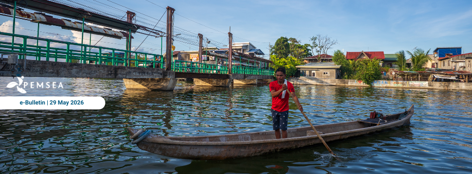
PEMSEA eBulletin - May 2026
Dear PEMSEA community,
The month of May marked continued progress in strengthening capacity building and collaboration across the East Asian Seas!
In Indonesia, read how IPB University convened the Summer Course on Marine Litter Management, Policy, and Integrated Coastal Governance. Discover how the PEMSEA Resource Facility supported the PEMSEA Network of Learning Centers (PNLC) as regional experts gathered in Bogor to train international students and early-career researchers. Ms. Nancy Bermas, Regional Project Manager of the GEF/UNDP/ASEAN Integrated River Basin Management Project, represented PRF and delivered a lecture on cross-country marine litter governance and management. She introduced PEMSEA’s Framework for Sustainable Development of Coastal and Marine Areas, highlighting how marine litter responses can align with global, regional, national, and local action plans, while using Manila Bay as a case study for multi-stakeholder collaboration. Ms. Bermas also shared how PRF’s IRBM Project and the MOF/PEMSEA Marine Plastics ODA Project on Reducing Marine Plastics are supporting regional efforts in marine litter and plastic waste management.
In the Philippines, discover how efforts to protect the Ticao-Burias Pass Protected Seascape (TBPPS) are translating into concrete local action as PEMSEA, the ASEAN Centre for Biodiversity (ACB), and DENR-BMB held a second major training workshop in Legazpi City on Integrated Coastal Management (ICM) and Marine Spatial Planning. In Thailand, read about the ASEAN ENMAPS project’s efforts to strengthen ICM and Marine Spatial Planning for marine protected area management through its training workshop.

Proceedings of the PNLC Regional Workshop: From Knowledge to Action Scaling Blue Carbon Initiatives in the East Asian Region
The Regional Workshop entitled “PNLC Regional Workshop: From Knowledge to Action: Scaling Blue Carbon Initiatives in the East Asian Region” was hosted by the PEMSEA Network of Learning Centers (PNLC) and held in Antipolo, Philippines, from 25–26 March 2026.
The workshop brought together 43 participants including experts, speakers, and representatives from PNLC member institutions from 8 countries across the region, namely Cambodia, China, Lao PDR, Indonesia, the Philippines, Thailand, Timor-Leste, and Vietnam.
Co-sponsored by the Luce Foundation, University of Hawai‘i, University of the Philippines–Marine Science Institute, the Ministry of Environment Indonesia, and the PNLC, and organized by the PNLC Secretariat in coordination with the PEMSEA Resource Facility.