Breadcrumb
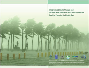
Integrating climate change and disaster risk scenarios into coastal land and sea use planning in Manila Bay
PUBLICATION DATE:
Friday, June 01, 2012
PUBLICATION TYPE:
Reports
STATUS:
Out of Print
DESCRIPTION:
One of the key issues facing governments throughout the East Asian Seas (EAS) region is the impact of climate change, variability and extremes, particularly in coastal areas. Manila Bay is no exception, with incidents of flooding, storm surges, saltwater intrusion and erosion occurring with increasing frequency or heightened intensity. Of special concern is the threat of sea level rise in the Bay area and its effects on infrastructure as well as social and economic development in the area. The Manila Declaration, which was signed by the Ministers and Senior Government Officials from the Partnerships in Environmental Management for the Seas of East Asia (PEMSEA) Partner Countries in December 2009, called for countries of the region to strengthen and accelerate the implementation of integrated coastal management (ICM) for sustainable development and climate change adaptation in coastal areas of the region. In Manila Bay, the Department of Environment and Natural Resources (DENR) – River Basin Coordinating Office (RBCO), Coastal and Marine Management Office (CMMO) and Manila Bay Coordinating Office (MBCO), and PEMSEA have been working with local government units (LGUs) to scale up the implementation of ICM around the Bay’s coastline, building on the experience of ICM programs in the Provinces of Bataan and Cavite. One of the major thrusts of ICM development and implementation is the preparation of an integrated land and sea use plan. This calls for the conduct of coastal use zoning, which will serve as a guide in the preparation of a plan and regulatory system to allocate the appropriate zones and corresponding uses of the coastal and marine area. Coastal use zoning is based on the functional capability and suitability of coastal waters and land as to the desired uses, the development envisioned by the stakeholders, existing policies and ecological, cultural and traditional considerations. The zoning process is a socio-political matter requiring scientific and technical inputs, involving multi-sector participation and extensive consultation with concerned stakeholders in order to reach consensus on the various zones and their corresponding uses. A major gap in previous meetings and consultations concerning the sustainable development of Manila Bay is the lack of existing and projected impacts of climate change, variability and extremes on the area. Similarly, inputs to the development of integrated land and sea use plans by the local governments in Bataan and Cavite have been lacking guidance and information on changes that are expected to occur because of sea level rise, as well as other potential impacts of climate change (e.g., more intense rainfall or more intense storms). To address this gap, “macro-scale” land and sea use zones for Manila Bay will be prepared with a specific focus on the different scenarios for sea level rise, flooding and storm surges as a consequence of climate change, variability and extremes in the coastal areas over the next 50 years. This document will provide information on climate change, variability and extremes and sea level rise, as inputs to the coastal land and sea use planning and zoning along the Manila Bay area. The physical boundaries of the coastal area to which the Coastal Land and Water Use Plan applies is governed by the Philippine Fisheries Code of 1998 (Republic Act 8550).
RELATED PUBLICATIONS
-
MOF/PEMSEA Marine Plastics ODA Project Second Regional Steering Committee Meeting
The Regional Steering Committee (RSC) meeting is the main decision making body of the Official Development Assistance (ODA) Project entitled “Reducing Marine Plastics in the East Asian Seas Region” comprised of the donor: the Government of Republic of Korea represented by the Ministry of Oceans and Fisheries (MOF), and the participating countries: the Philippines, represented by the Department of Natural Resources and Environment (DENR) and Timor-Leste, represented by the Ministry of Agriculture, Livestock, Fisheries and Forestry (MALFF) in collaboration with the Ministry of Tourism and Environment (MTE) and Ministry of State Administration (MSA). The Regional Project Management Unit (RPMU) of the PEMSEA Resource Facility (PRF) of Partnerships in Environmental Management for the Seas of East Asia (PEMSEA) serves as the Secretariat to the RSC.
The RSC meets at least once a year to report on the progress of the project, sets its strategic directions and guidance and approves work plan and budget for the following year’s project activities. The inaugural RSC meeting in 2023 was chaired by the Government of the Philippines, represented by H.E. Undersecretary Jonas Leones of the DENR. This year, the 2nd RSC meeting was chaired by the Government of Timor-Leste, as represented by the Advisor to the Secretary of State for Fisheries, MALFF, Mr. Aleixo Leonito Amaral.
The 2nd RSC Meeting was held on 17 December 2024 via hybrid format at Radisson Park Inn, Quezon City and Zoom.
-
MOF/PEMSEA Marine Plastics ODA Project Intersessional Regional Steering Committee Meeting
The Intersessional Regional Steering Committee (RSC) Meeting of the MOF/PEMSEA ODA Project on Reducing Marine Plastics in the East Asian Seas Region was held on 17 September 2025 via Zoom, in line with the agreements made during the 2nd RSC Meeting in December 2024. The primary objective of this session was to review and endorse the detailed designs of pilot projects in the six Philippine project sites: Bulan, Calbayog, Daanbantayan, Dipolog, Puerto Princesa, and Tandag.
These pilot projects form part of Component 2 of the ODA Project, which focuses on demonstrating best practices and locally adapted solutions for marine plastics reduction. Designed to respond directly to site-specific challenges identified during the baseline assessments, the pilot projects aim to improve local plastics and waste management systems, enhance community engagement, and reduce the leakage of plastic waste into coastal and marine environments. The interventions are aligned with national and local priorities.
During the 2nd RSC meeting in 2024, the pilot project concepts for the Philippine sites were approved. Subsequently, the detailed designs of the pilot projects have been developed by the consulting firm, EECI, Inc., in close collaboration with local government units (LGUs) in 2025. These designs reflect the insights, technical inputs, feasibility, and on-ground realities gathered through extensive stakeholder consultations.
The Intersessional RSC meeting was an essential step to ensure that the proposed interventions are sound, feasible, and ready for implementation. The outcomes will not only guide the pilot project implementation but also reinforce the collective commitment of project partners to achieve measurable impacts in reducing marine plastics in the Philippines.
The meeting was organized in hybrid format: at the conference room of the office of Undersecretary Jonas R. Leones and through Zoom for the online participants.
-
MOF/PEMSEA Marine Plastics ODA Project Third Regional Steering Committee Meeting
The Regional Steering Committee (RSC) meeting is the main decision making body of the Official Development Assistance (ODA) Project entitled “Reducing Marine Plastics in the East Asian Seas Region” comprised of the donor: the Government of Republic of Korea represented by the Ministry of Oceans and Fisheries (MOF), and the participating countries: the Philippines, represented by the Department of Natural Resources and Environment (DENR) and Timor-Leste, represented by the Ministry of Agriculture, Livestock, Fisheries and Forestry (MALFF) in collaboration with the Ministry of Tourism and Environment (MTE) and Ministry of State Administration (MSA). The Regional Project Management Unit (RPMU) of the PEMSEA Resource Facility (PRF) of Partnerships in Environmental Management for the Seas of East Asia (PEMSEA) serves as the Secretariat to the RSC.
The RSC meets at least once a year to review project progress, provide strategic direction and guidance, and approve the work plan and budget for the subsequent year’s project activities. The Chair of the RSC rotates among the participating countries. The inaugural RSC meeting in 2023 was chaired by the Government of the Philippines, represented by H.E. Undersecretary Jonas Leones of the Department of Environment and Natural Resources (DENR). The second RSC meeting was chaired by the Government of Timor-Leste, represented by Mr. Aleixo Leonito Amaral, Advisor to the Secretary of State for Fisheries, Ministry of Agriculture, Livestock, Fisheries and Forestry (MALFF). For the third RSC, the meeting was chaired by the Philippines, represented by Dr. Al O. Orolfo, Director of the DENR Foreign-Assisted and Special Projects Service (FASPS).
The 3rd RSC Meeting was held via Zoom on 10 December 2025.
-
MOF/PEMSEA Marine Plastics ODA Project Interim Regional Steering Committee Meeting
The Regional Steering Committee (RSC) meeting is the highest decision making body of the Official Development Assistance (ODA) Project entitled “Reducing Marine Plastics in the East Asian Seas Region” comprised of the donor: the Government of Republic of Korea represented by the Ministry of Oceans and Fisheries (MOF), and the participating countries: the Philippines, represented by the Department of Natural Resources and Environment (DENR) and Timor-Leste, represented by the Ministry of Agriculture, Livestock, Fisheries and Forestry (MALFF) and the Ministry of Tourism and Environment (MTE). The Regional Project Management Unit (RPMU) of the PEMSEA Resource Facility (PRF) of Partnerships in Environmental Management for the Seas of East Asia (PEMSEA) serves as the Secretariat.
The RSC convenes every year to report the progress and approve work plan and budget for the following year’s project activities. The chairmanship is assumed by both participating countries on an alternating basis. This inaugural RSC meeting was organized in Manila, Philippines and chaired by the Government of the Philippines, represented by H.E. Undersecretary Jonas Leones of the DENR.
The Interim RSC Meeting was held on 12 December 2023 via Zoom.
