Breadcrumb
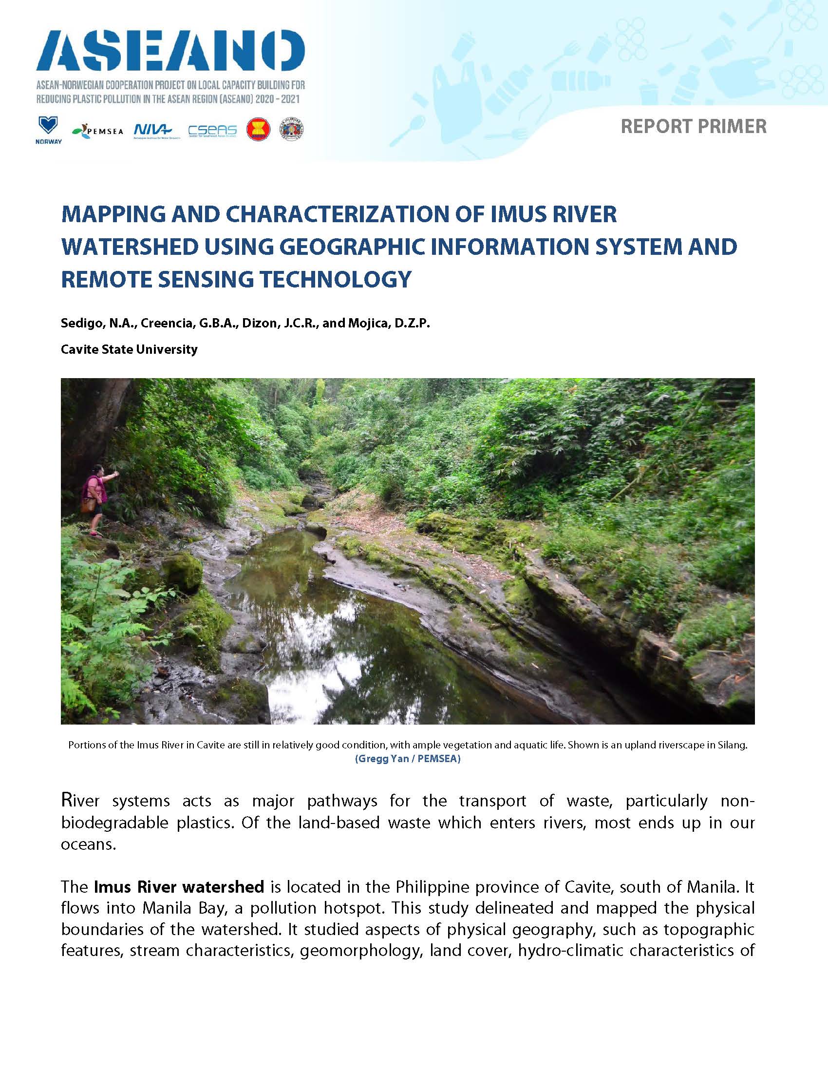
ASEANO Primer: Mapping and Characterization of the Imus River Watershed
PUBLICATION DATE:
Monday, April 18, 2022
PUBLICATION TYPE:
Reports
STATUS:
Only Available Online
DESCRIPTION:
Both primary and secondary data sources were used to make comprehensive land use maps, population maps, and hydro-climatic data analyses. The boundary of the Imus River watershed was established using a digital elevation model of the province of Cavite in ArcGIS. Sangley Point Synoptic Station in Cavite and the CvSU-PAGASA Agrometeorological Station in Indang were used to assess the general hydro-climatic condition of IRW due to their close proximity to the watershed.
RELATED PUBLICATIONS
-
MOF/PEMSEA Marine Plastics ODA Project Second Regional Steering Committee Meeting
The Regional Steering Committee (RSC) meeting is the main decision making body of the Official Development Assistance (ODA) Project entitled “Reducing Marine Plastics in the East Asian Seas Region” comprised of the donor: the Government of Republic of Korea represented by the Ministry of Oceans and Fisheries (MOF), and the participating countries: the Philippines, represented by the Department of Natural Resources and Environment (DENR) and Timor-Leste, represented by the Ministry of Agriculture, Livestock, Fisheries and Forestry (MALFF) in collaboration with the Ministry of Tourism and Environment (MTE) and Ministry of State Administration (MSA). The Regional Project Management Unit (RPMU) of the PEMSEA Resource Facility (PRF) of Partnerships in Environmental Management for the Seas of East Asia (PEMSEA) serves as the Secretariat to the RSC.
The RSC meets at least once a year to report on the progress of the project, sets its strategic directions and guidance and approves work plan and budget for the following year’s project activities. The inaugural RSC meeting in 2023 was chaired by the Government of the Philippines, represented by H.E. Undersecretary Jonas Leones of the DENR. This year, the 2nd RSC meeting was chaired by the Government of Timor-Leste, as represented by the Advisor to the Secretary of State for Fisheries, MALFF, Mr. Aleixo Leonito Amaral.
The 2nd RSC Meeting was held on 17 December 2024 via hybrid format at Radisson Park Inn, Quezon City and Zoom.
-
MOF/PEMSEA Marine Plastics ODA Project Intersessional Regional Steering Committee Meeting
The Intersessional Regional Steering Committee (RSC) Meeting of the MOF/PEMSEA ODA Project on Reducing Marine Plastics in the East Asian Seas Region was held on 17 September 2025 via Zoom, in line with the agreements made during the 2nd RSC Meeting in December 2024. The primary objective of this session was to review and endorse the detailed designs of pilot projects in the six Philippine project sites: Bulan, Calbayog, Daanbantayan, Dipolog, Puerto Princesa, and Tandag.
These pilot projects form part of Component 2 of the ODA Project, which focuses on demonstrating best practices and locally adapted solutions for marine plastics reduction. Designed to respond directly to site-specific challenges identified during the baseline assessments, the pilot projects aim to improve local plastics and waste management systems, enhance community engagement, and reduce the leakage of plastic waste into coastal and marine environments. The interventions are aligned with national and local priorities.
During the 2nd RSC meeting in 2024, the pilot project concepts for the Philippine sites were approved. Subsequently, the detailed designs of the pilot projects have been developed by the consulting firm, EECI, Inc., in close collaboration with local government units (LGUs) in 2025. These designs reflect the insights, technical inputs, feasibility, and on-ground realities gathered through extensive stakeholder consultations.
The Intersessional RSC meeting was an essential step to ensure that the proposed interventions are sound, feasible, and ready for implementation. The outcomes will not only guide the pilot project implementation but also reinforce the collective commitment of project partners to achieve measurable impacts in reducing marine plastics in the Philippines.
The meeting was organized in hybrid format: at the conference room of the office of Undersecretary Jonas R. Leones and through Zoom for the online participants.
-
MOF/PEMSEA Marine Plastics ODA Project Third Regional Steering Committee Meeting
The Regional Steering Committee (RSC) meeting is the main decision making body of the Official Development Assistance (ODA) Project entitled “Reducing Marine Plastics in the East Asian Seas Region” comprised of the donor: the Government of Republic of Korea represented by the Ministry of Oceans and Fisheries (MOF), and the participating countries: the Philippines, represented by the Department of Natural Resources and Environment (DENR) and Timor-Leste, represented by the Ministry of Agriculture, Livestock, Fisheries and Forestry (MALFF) in collaboration with the Ministry of Tourism and Environment (MTE) and Ministry of State Administration (MSA). The Regional Project Management Unit (RPMU) of the PEMSEA Resource Facility (PRF) of Partnerships in Environmental Management for the Seas of East Asia (PEMSEA) serves as the Secretariat to the RSC.
The RSC meets at least once a year to review project progress, provide strategic direction and guidance, and approve the work plan and budget for the subsequent year’s project activities. The Chair of the RSC rotates among the participating countries. The inaugural RSC meeting in 2023 was chaired by the Government of the Philippines, represented by H.E. Undersecretary Jonas Leones of the Department of Environment and Natural Resources (DENR). The second RSC meeting was chaired by the Government of Timor-Leste, represented by Mr. Aleixo Leonito Amaral, Advisor to the Secretary of State for Fisheries, Ministry of Agriculture, Livestock, Fisheries and Forestry (MALFF). For the third RSC, the meeting was chaired by the Philippines, represented by Dr. Al O. Orolfo, Director of the DENR Foreign-Assisted and Special Projects Service (FASPS).
The 3rd RSC Meeting was held via Zoom on 10 December 2025.
-
MOF/PEMSEA Marine Plastics ODA Project Interim Regional Steering Committee Meeting
The Regional Steering Committee (RSC) meeting is the highest decision making body of the Official Development Assistance (ODA) Project entitled “Reducing Marine Plastics in the East Asian Seas Region” comprised of the donor: the Government of Republic of Korea represented by the Ministry of Oceans and Fisheries (MOF), and the participating countries: the Philippines, represented by the Department of Natural Resources and Environment (DENR) and Timor-Leste, represented by the Ministry of Agriculture, Livestock, Fisheries and Forestry (MALFF) and the Ministry of Tourism and Environment (MTE). The Regional Project Management Unit (RPMU) of the PEMSEA Resource Facility (PRF) of Partnerships in Environmental Management for the Seas of East Asia (PEMSEA) serves as the Secretariat.
The RSC convenes every year to report the progress and approve work plan and budget for the following year’s project activities. The chairmanship is assumed by both participating countries on an alternating basis. This inaugural RSC meeting was organized in Manila, Philippines and chaired by the Government of the Philippines, represented by H.E. Undersecretary Jonas Leones of the DENR.
The Interim RSC Meeting was held on 12 December 2023 via Zoom.
