Measuring ICM Success: Lessons from the second Bataan SOC
Monday, 29 July 2024
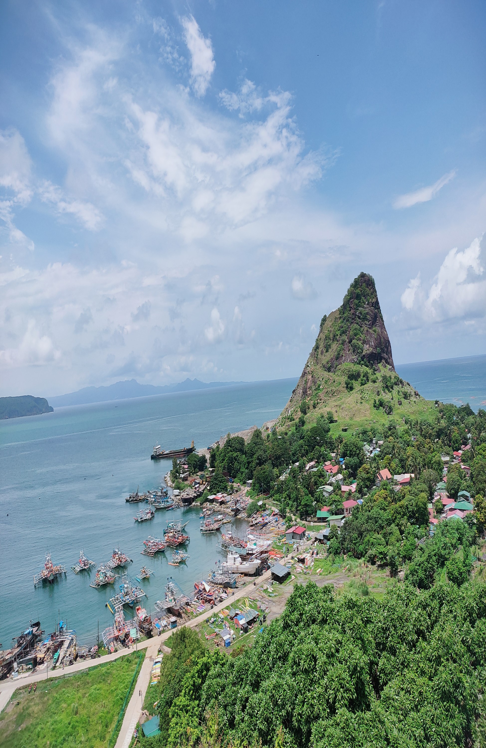
Mariveles, a coastal municipality in the province of Bataan, is located around Mariveles Bay at the southern tip of the Bataan Peninsula. It has the longest coastline in the area, stretching 60.303 km.
For more than two decades, Bataan province’s Integrated Coastal Management (ICM) program has been a successful approach to fostering sustainable development in the coastal areas of the peninsula, and ensuring local communities are empowered to take informed decisions.
The first Bataan SOC report
The inaugural State of the Coasts (SOC) report of Bataan was released in 2017 and established a firm baseline of information covering the years from 2000 to 2015. This initial report introduced the Bataan Sustainable Development Strategy (BSDS) and the Bataan Coastal Land and Sea Use Zoning Plan (CLSUZP), designed to mainstream coastal management efforts within the province’s planning processes.
The wide range of governance, socioeconomic and environmental indicators covered in the SOC created a quantitative and qualitative baseline for systematic monitoring and assessment of Bataan’s coastal management efforts.
Through legislation, enforcement, information campaigns and capacity building initiatives, Bataan’s early efforts focused on creating a strong framework to integrate various stakeholders, including government agencies, NGOs, and local communities, into coastal management and governance.
The BSDS outlines broad action programs ranging from participatory information, education, and communication (IEC) projects to the mitigation of environmental damages, protection and rehabilitation of critical habitats, and rational development pursuits, including poverty alleviation in coastal communities.
The CLSUZP, as a spatial planning tool, resolves issues and multiple-use conflicts in the coastal and marine areas, complementing the province’s comprehensive land use plan and guiding municipal local government units (LGUs) in developing their respective zoning plans.
Lessons learned from a continuous SOC process
Six years after the publication of the first SOC report, the second SOC report was published in 2023, based on data from the years 2017 to 2022. The publication of a second report allowed for a shifting focus from setting the benchmarks for policies, coastal management framework and programs to monitoring their implementation and impacts. The second report builds upon the established baseline and provides a detailed evaluation of how the BSDS and CLSUZP have been implemented and their effectiveness in addressing coastal issues through ICM.
The evaluation showed Bataan’s progress relative to the 35 core governance and management indicators since the first publication of the SOC. Of the 14 governance indicators, 12 showed improving conditions while two indicators for the institutional arrangements indicated a need for further improvements status.
All other governance indicators, such as policy, strategies and plans, legislation, information and public awareness, capacity development and financing mechanisms showed improving conditions.
In terms of public education and awareness for example, the provincial and municipal governments continue to build strong collaboration and partnership with the Department of Environment and Natural Resources (DENR) and the private sector in raising public awareness and education on environmental issues, including the conduct of the Bataan Environment Summit, which engaged high school students in discussions on plastic pollution and environmental responsibility; webinars on priority environmental issues such as climate change, biodiversity, and forest protection for the celebration of the Month of the Environment; barangay-level sessions on waste management, among others.
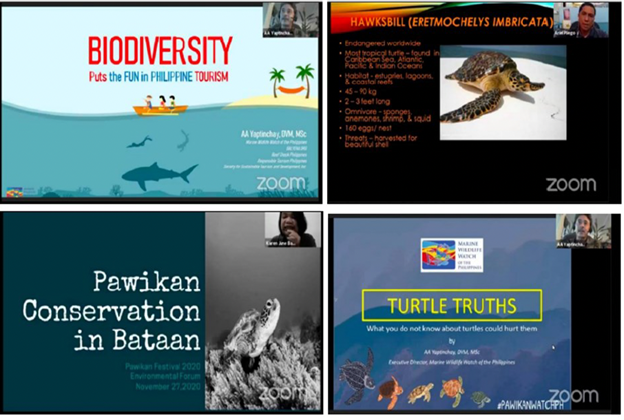
As part of their IEC activities, the Bataan PG-ENRO hosted the Pawikan Festival with its first Virtual Environmental Forum, focusing on pawikan conservation, youth involvement in marine preservation, and biodiversity protection.
Under the 21 sustainable development indicators, 14 indicators for natural and man-made hazard prevention, habitat protection, water use and supply, food security and livelihood and pollution reduction and waste management showed improving conditions. Three of these indicators showed discernible improvements particularly fisheries production, livelihood programs, and industrial, agricultural, and hazardous wastes.
In terms of fisheries production for example, Bataan’s contribution to Region III (Central Luzon) fisheries production averaged 9.7%, translating to an annual average of 30,271.8 metric tons (MT) from 2016 to 2021.
However, recent declines in production raised concerns about sustainability brought about by illegal, unreported, and unregulated fishing, loss of fishing grounds and habitats, and adverse weather conditions. Strengthening the monitoring and surveillance mechanisms for better law enforcement; establishing fish sanctuaries and marine protected areas; and formulating fisheries management plans to ensure sustainable fish stocks and production are recommended to address these challenges.
Three sustainable development indicators, including water conservation and management; water quality and air quality require further improvements, while the indicator on reclamation and conversion indicator showed a deteriorating trend.
Coastal habitat conversion and reclamation in Bataan raised environmental and regulatory concerns particularly in relation to the conversion of mangroves into fishponds, the expansion of reclaimed land, and foreshore development.
Regulatory frameworks to halt further effects of reclamation and conversion are already in place and implemented by various agencies. Reclamation and foreshore development in Bataan are regulated by the Philippine Reclamation Authority (PRA), the Department of Environment and Natural Resources (DENR), and the Provincial Government.
Projects require permits and lease agreements from these authorities. The PRA has already halted some reclamation projects, such as port and coastal road developments, due to pending permits. The Freeport Area of Bataan Authority and PRA are drafting new guidelines for reviewing and approving reclamation activities in the freeport area.
Regulatory policies such as the Bataan Environment Code prohibits construction within 20 meters of the shoreline at high tide while coastal development projects must obtain an approving resolution issued by the Provincial Development Council (Sangguniang Panlalawigan). It is recommended that the provincial and municipal governments should continue to regularly assess and evaluate approved reclamation and foreshore developments to minimize environmental impacts.
Building for the future
The transition from the first to the second SOC emphasized the role of SOC reporting in the ICM implementation, making sure that coastal management efforts stay adaptive to emerging challenges and identifying areas that require further improvements.

